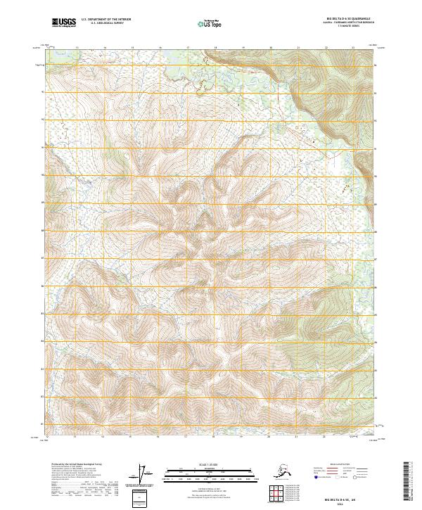
2024 Map of Big Delta D-6 SE
USGS Topo · Published 2024About this map
Chena River and its southern branch define the drainage patterns of this Alaskan interior landscape in the Fairbanks North Star Borough. The terrain is shaped by the complex valley system of the South Fork Chena River, which snakes through the eastern and northern portions of the map. This area represents a wilderness largely defined by seasonal accessibility and historic travel routes rather than permanent settlements. Two primary overland paths, the South Fork Winter Trl and the Mastodon Trl, serve as the principal corridors for movement through the high ground and marshy lowlands. Numerous smaller tributaries, including Hunts Creek and Globe Creek, feed into the larger river systems, illustrating the hydrological network that sustains this subarctic environment.
Find a feature on this map
12 named features on this map. Tap any name to fly to it.
Don’t see what you’re looking for? This feature index may not catch every label — zoom into the map to look around manually.
Map Details
Editions of this 2024 Big Delta D-6 SE Map
This is the sole edition of this map. No revisions or reprints were ever made.
Other maps of this area

1949 · Big Delta C-6
USGS Topo · 1:63,360

1950 · Big Delta
USGS Topo · 1:250,000

1950 · Big Delta D-6
USGS Topo · 1:63,360

1951 · Big Delta
USGS Topo · 1:250,000

1952 · Big Delta C-6
USGS Topo · 1:63,360

1952 · Big Delta D-6
USGS Topo · 1:63,360

1958 · Big Delta C-5
USGS Topo · 1:63,360

1958 · Big Delta D-5
USGS Topo · 1:63,360

1958 · Big Delta
USGS Topo · 1:250,000
1992 · Big Delta D-6 SW
USGS Topo · 1:25,000