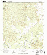
1970 Map of Big Draw
USGS Topo · Published 1973About this map
The Llano River snakes across this Kimble County landscape, joined by its tributaries at a time when the region was defined by its water sources and rugged elevation. High points like Teacup Mountain overlook a network of seasonal drainages including Gorman Draw and the namesake Big Draw. The presence of Gorman Spring and numerous wells indicates the importance of reliable water in this Texas Hill Country terrain.
Find a feature on this map
14 named features on this map. Tap any name to fly to it.
Don’t see what you’re looking for? This feature index may not catch every label — zoom into the map to look around manually.
Map Details
Editions of this 1970 Big Draw Map
2 editions found
Other maps of this area

1932 · Junction
USGS Topo · 1:62,500

1954 · Llano
USGS Topo · 1:250,000

1955 · Llano
USGS Topo · 1:250,000

1956 · Llano
USGS Topo · 1:250,000

1968 · London
USGS Topo · 1:24,000

1968 · Yates
USGS Topo · 1:24,000

1970 · Julio Draw
USGS Topo · 1:24,000

1970 · Brewer Hollow
USGS Topo · 1:24,000

1970 · Elm Slough
USGS Topo · 1:24,000
1970 · Big Draw
USGS Topo · 1:24,000