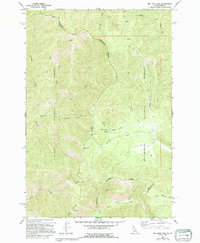
1966 Map of Big Hole Pass
USGS Topo · Published 1994About this map
The Continental Divide snake along the high ridgelines of the Beaverhead Mountains, serving as the natural boundary between Lemhi County, Idaho, and Beaverhead County, Montana. This mid-century survey reveals a landscape defined by its mining and backcountry history, where a Pack Trail winds through the high-altitude terrain to cross at Big Hole Pass. Local exploration is evidenced by multiple prospects and name-driven landmarks like Morgan Mtn and Eagle Mtn. Drainage systems like Dahlonega Creek and West Fork Rabbit Creek flow from these heights into the surrounding Salmon National Forest and Beaverhead National Forest. The presence of Morgan Jones Lake and the various gulches, such as Bradley Gulch and Thompson Gulch, illustrates the water-driven erosion patterns of the northern Rockies before modern development altered these remote territories.
Find a feature on this map
31 named features on this map. Tap any name to fly to it.
Don’t see what you’re looking for? This feature index may not catch every label — zoom into the map to look around manually.
Map Details
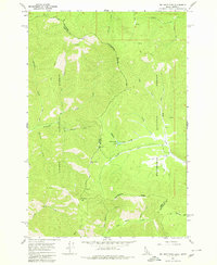
Editions of this 1966 Big Hole Pass Map
3 editions found
Other maps of this area

1955 · Dillon
USGS Topo · 1:250,000

1957 · Dillon
USGS Topo · 1:250,000

1958 · Dillon
USGS Topo · 1:250,000

1962 · Dillon
USGS Topo · 1:250,000

1965 · Dillon
USGS Topo · 1:250,000

1966 · Lost Trail Pass
USGS Topo · 1:24,000

1966 · Shewag Lake
USGS Topo · 1:24,000

1966 · Big Hole Battlefield
USGS Topo · 1:24,000

1966 · Jumbo Mountain
USGS Topo · 1:24,000

1966 · Big Hole Pass
USGS Topo · 1:24,000