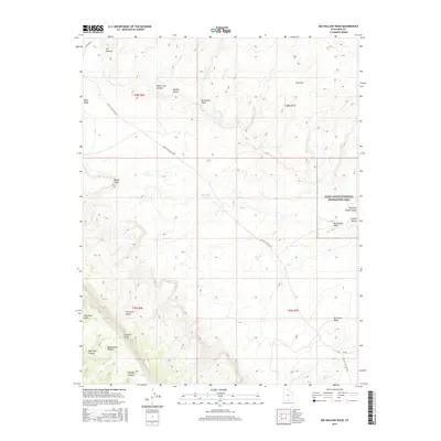
2017 Map of Big Hollow Wash
USGS Topo · Published 2017About this map
The Kaiparowits Plateau dominates this desert landscape, its southern terminus marked by the dramatic Straight Cliffs. This 2017 survey by the U.S. Geological Survey shows a network of intricate drainages and narrows that define the local geography, including the famously tight slots of Peek-a-boo Canyon and Spooky Gulch near Brimstone Gulch. Much of the eastern portion of the map is contained within the Glen Canyon National Recreation Area, where the ephemeral Big Hollow Wash leads toward the complex system of Coyote Gulch. The historic corridor of Hole in the Rock Rd provides the primary access through this arid environment, passing near prominent landmarks like Fiftymile Bench and Cat Pasture. This modern topographic study details the critical water sources in a parched terrain, such as Big Hollow Spring and Cottonwood Spring, which have sustained travelers and livestock for generations.
Find a feature on this map
26 named features on this map. Tap any name to fly to it.
Don’t see what you’re looking for? This feature index may not catch every label — zoom into the map to look around manually.
Map Details
Editions of this 2017 Big Hollow Wash Map
This is the sole edition of this map. No revisions or reprints were ever made.
Other maps of this area

1886 · Escalante
USGS Topo · 1:250,000

1922 · Rees Canyon
USGS Topo · 1:63,360

1953 · Circle Cliffs 4 SW
USGS Topo · 1:24,000

1953 · Moody Creek
USGS Topo · 1:62,500

1956 · Escalante
USGS Topo · 1:250,000

1960 · Escalante
USGS Topo · 1:250,000

1964 · Sunset Flat
USGS Topo · 1:24,000

1968 · East of The Navajo
USGS Topo · 1:24,000
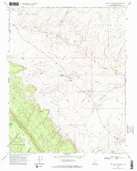
1968 · Big Hollow Wash
USGS Topo · 1:24,000
1968 · Basin Canyon
USGS Topo · 1:24,000