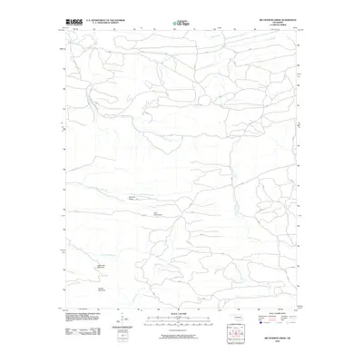
2010 Map of Big Hudson Creek
USGS Topo · Published 2010About this map
Big Hudson Creek meanders through this portion of McCurtain County, Oklahoma, defining a landscape shaped by significant topographic relief and a dense network of upland drainage. The terrain is characterized by prominent elevations including the Pine Mountains and Slapover Ridge, which separate the various creek basins. The mapping detail shows a complex web of unnamed local roads and timber trails that navigate between White Oak Mountain and Locust Mountain. This drainage pattern, featuring Robinson Creek, Bull Creek, and Otter Creek, suggests a region largely dedicated to forestry and natural resource management in the early twenty-first century. The absence of concentrated town centers highlights the rural, undeveloped character of this specific quadrangle, making it a clear study of the high ridgelines and stream valleys that define the geography of southeastern Oklahoma.
Find a feature on this map
13 named features on this map. Tap any name to fly to it.
Don’t see what you’re looking for? This feature index may not catch every label — zoom into the map to look around manually.
Map Details
Editions of this 2010 Big Hudson Creek Map
This is the sole edition of this map. No revisions or reprints were ever made.
Other maps of this area

1902 · Lukfata
USGS Topo · 1:125,000

1913 · De Queen
USGS Topo · 1:125,000

1950 · Mcalester
USGS Topo · 1:250,000

1959 · Cove
USGS Topo · 1:62,500

1959 · Broken Bow
USGS Topo · 1:62,500

1960 · Smithville
USGS Topo · 1:62,500

1962 · McAlester
USGS Topo · 1:250,000

1965 · McAlester
USGS Topo · 1:250,000
1966 · De Queen NW
USGS Topo · 1:24,000
1976 · Broken bow NE
USGS Topo · 1:24,000