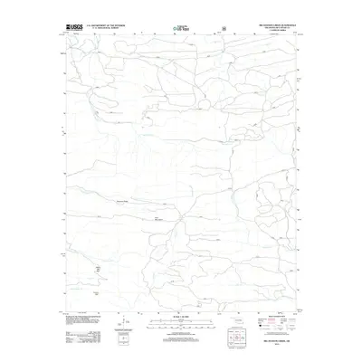
2013 Map of Big Hudson Creek
USGS Topo · Published 2013About this map
Pine Mountains and the prominent Slapover Ridge define the central topography of this McCurtain County landscape. The drainage patterns here are complex, with waters flowing from high points like White Oak Mtn and Locust Mtn into numerous winding streams. The namesake Big Hudson Cr meanders across the upper half of the quadrangle, while the southern portion is marked by the split forks of North Linson Cr and South Linson Cr.
Find a feature on this map
46 named features on this map. Tap any name to fly to it.
Don’t see what you’re looking for? This feature index may not catch every label — zoom into the map to look around manually.
Map Details
Editions of this 2013 Big Hudson Creek Map
This is the sole edition of this map. No revisions or reprints were ever made.
Other maps of this area

1902 · Lukfata
USGS Topo · 1:125,000

1913 · De Queen
USGS Topo · 1:125,000

1950 · Mcalester
USGS Topo · 1:250,000

1959 · Cove
USGS Topo · 1:62,500

1959 · Broken Bow
USGS Topo · 1:62,500

1960 · Smithville
USGS Topo · 1:62,500

1962 · McAlester
USGS Topo · 1:250,000

1965 · McAlester
USGS Topo · 1:250,000
1966 · De Queen NW
USGS Topo · 1:24,000
1976 · Broken bow NE
USGS Topo · 1:24,000