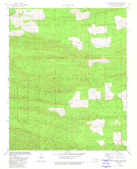
1981 Map of Big Hudson Creek
USGS Topo · Published 1981About this map
Pine Mountain State Wilderness Area dominates this section of the Ouachita highlands, preserving a landscape defined by parallel ridges and seasonal drainages. Established within McCurtain County, the terrain is characterized by prominent elevations such as Slapover Ridge and the Pine Mountains. The drainage pattern is intricate, with Big Hudson Creek and its tributaries, including North Linson Creek and South Linson Creek, cutting through the narrow valleys. The presence of Pine Mountain Spring and several identified stream crossings, simply marked as Ford, indicates the historical importance of water access for travelers and local land use. To the south, the landscape transitions into the distinct formations of White Oak Mountain, Little White Oak Mountain, and Locust Mountain, illustrating the complex geological folding of the region.
Find a feature on this map
17 named features on this map. Tap any name to fly to it.
Don’t see what you’re looking for? This feature index may not catch every label — zoom into the map to look around manually.
Map Details
Editions of this 1981 Big Hudson Creek Map
This is the sole edition of this map. No revisions or reprints were ever made.
Other maps of this area

1902 · Lukfata
USGS Topo · 1:125,000

1913 · De Queen
USGS Topo · 1:125,000

1950 · Mcalester
USGS Topo · 1:250,000

1959 · Cove
USGS Topo · 1:62,500

1959 · Broken Bow
USGS Topo · 1:62,500

1960 · Smithville
USGS Topo · 1:62,500

1962 · McAlester
USGS Topo · 1:250,000

1965 · McAlester
USGS Topo · 1:250,000
1966 · De Queen NW
USGS Topo · 1:24,000
1976 · Broken bow NE
USGS Topo · 1:24,000