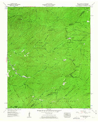
1957 Map of Big Junction
USGS Topo · Published 1963About this map
Tellico River winds through the high ridges of the Unicoi Mountains along the Tennessee and North Carolina border, anchoring a landscape dedicated to timber and conservation. The presence of the Bemis Logging Camp and Tellico River Lodge reflects the area's mid-century identity as a hub for both industrial extraction and burgeoning mountain recreation. This 1957 field examination captures the complex administrative boundaries of the era, where the Cherokee National Forest and Nantahala National Forest meet across the state line.
Find a feature on this map
110 named features on this map. Tap any name to fly to it.
Don’t see what you’re looking for? This feature index may not catch every label — zoom into the map to look around manually.
Map Details
Editions of this 1957 Big Junction Map
4 editions found

Other maps of this area

1893 · Murphy
USGS Topo · 1:125,000

1914 · Murphy
USGS Topo · 1:125,000

1927 · Big Junction
USGS Topo · 1:24,000

1933 · Haw Knob
USGS Topo · 1:48,000

1933 · Whiteoak Flats
USGS Topo · 1:24,000

1933 · Bald River Falls
USGS Topo · 1:24,000

1933 · Rafter
USGS Topo · 1:24,000

1934 · McDaniel Bald
USGS Topo · 1:24,000

1934 · Unaka
USGS Topo · 1:24,000

1934 · Murphy
USGS Topo · 1:48,000