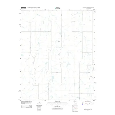
2012 Map of Big Kiowa Creek
USGS Topo · Published 2012About this map
The Washita River meanders across the northwestern corner of this landscape, defining the local hydrology alongside several notable tributaries. The drainage basins of Big Kiowa Cr and Little Kiowa Cr dominate the central terrain, while White Shield Cr flows through the eastern reaches. This rural Roger Mills County corridor is etched by a strict rectilinear road network, including routes like e0990 RD and n2000 RD, which connect the scattered agricultural lands. Local heritage is preserved in several small burial grounds that dot the prairie, specifically Red Hill Cem in the northeast, Kiowa Cem near the center, and Carpenter Cem in the southeast. These cemeteries serve as primary landmarks for genealogical research in an area defined more by its natural watercourses and section lines than by dense town centers.
Find a feature on this map
24 named features on this map. Tap any name to fly to it.
Don’t see what you’re looking for? This feature index may not catch every label — zoom into the map to look around manually.
Map Details
Editions of this 2012 Big Kiowa Creek Map
This is the sole edition of this map. No revisions or reprints were ever made.
Other maps of this area

1955 · Clinton
USGS Topo · 1:250,000

1957 · Clinton
USGS Topo · 1:250,000

1960 · Cheyenne
USGS Topo · 1:62,500

1960 · Sayre
USGS Topo · 1:62,500

1960 · Hammon
USGS Topo · 1:62,500

1961 · Elk City
USGS Topo · 1:62,500

1984 · Foss Reservoir
USGS Topo · 1:100,000

1985 · Elk City
USGS Topo · 1:100,000

1987 · Big Kiowa Creek
USGS Topo · 1:24,000

1987 · Elk City
USGS Topo · 1:24,000