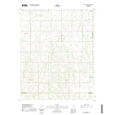
2018 Map of Big Kiowa Creek
USGS Topo · Published 2018About this map
The Washita River meanders through the northwest corner of this Western Oklahoma landscape, defining the northern reaches of a region characterized by deep creek drainages and section-line roads. Near the northern border, the town of Hammon serves as a local hub, while the small settlement of Carpenter sits near the eastern boundary. The terrain is etched by the intricate paths of Big Kiowa Cr, Little Kiowa Cr, and White Shield Cr, which carve through the plains and create a complex system of draws and ridges. For those tracing family histories or early land ties, several burial sites are documented across the townships, including Red Hill Cem east of Hammon, the centrally located Kiowa Cem, and Carpenter-Cem near the southern boundary. The map clearly delineates the convergence of several county lines, including the borders of Roger Mills, Custer, and Beckham counties.
Find a feature on this map
40 named features on this map. Tap any name to fly to it.
Don’t see what you’re looking for? This feature index may not catch every label — zoom into the map to look around manually.
Map Details
Editions of this 2018 Big Kiowa Creek Map
This is the sole edition of this map. No revisions or reprints were ever made.
Other maps of this area

1955 · Clinton
USGS Topo · 1:250,000

1957 · Clinton
USGS Topo · 1:250,000

1960 · Cheyenne
USGS Topo · 1:62,500

1960 · Sayre
USGS Topo · 1:62,500

1960 · Hammon
USGS Topo · 1:62,500

1961 · Elk City
USGS Topo · 1:62,500

1984 · Foss Reservoir
USGS Topo · 1:100,000

1985 · Elk City
USGS Topo · 1:100,000

1987 · Big Kiowa Creek
USGS Topo · 1:24,000

1987 · Elk City
USGS Topo · 1:24,000