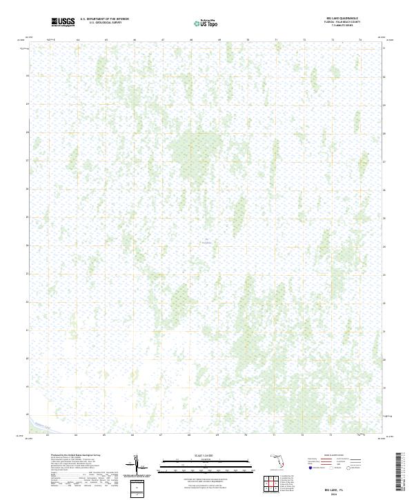
2024 Map of Big Lake
USGS Topo · Published 2024About this map
The Everglades dominates this 2024 landscape in Palm Beach County, appearing as a vast, intricate network of wetlands and sawgrass prairies. This specific quadrangle captures the characteristic marshy terrain of the northern reaches of the system, where the environment transitions into the managed water systems of South Florida. The only major engineering intervention visible is the Hillsboro Canal, which cuts across the southern margin of the sheet. This canal represents the legacy of early 20th-century drainage efforts designed to redirect water from Lake Okeechobee toward the Atlantic coast, a project that fundamentally reshaped the region's hydrology and land use patterns.
Find a feature on this map
2 named features on this map. Tap any name to fly to it.
Don’t see what you’re looking for? This feature index may not catch every label — zoom into the map to look around manually.
Map Details
Editions of this 2024 Big Lake Map
This is the sole edition of this map. No revisions or reprints were ever made.
Other maps of this area

1945 · Greenacres City
USGS Topo · 1:24,000

1946 · West Dixie Bend
USGS Topo · 1:24,000

1947 · Delmar Farms
USGS Topo · 1:24,000

1949 · West Dixie Bend
USGS Topo · 1:24,000

1949 · Delmar Farms
USGS Topo · 1:24,000

1950 · Greenacres City
USGS Topo · 1:24,000

1956 · West Palm Beach
USGS Topo · 1:250,000

1957 · West Palm Beach
USGS Topo · 1:250,000

1958 · West Palm Beach
USGS Topo · 1:250,000
1962 · West Dixie Bend
USGS Topo · 1:24,000