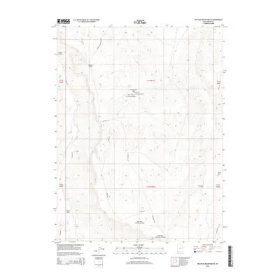
2014 Map of Big Pack Mountain SE
USGS Topo · Published 2014About this map
Buck Canyon Gas Field defines the industrial footprint of this high plateau region in Uintah County, where energy extraction meets a complex network of drainage systems. The landscape is carved by the Cottonwood Wash, including its distinct West Fork and East Fork branches, which join several other intermittent watercourses like Sand Wash and Willow Creek. These natural features dictate the winding paths of local transit, such as Seep Ridge Road and the West Fork Cottonwood Wash Road. The presence of Sulphur Spring and several named draws, such as Agency Draw, points to the critical importance of water sources in this arid environment. The map provides a detailed look at the infrastructure required for resource management, including uniquely named tracks like Wrong Way and Hells Edge that navigate the varied terrain of Broome Canyon.
Find a feature on this map
23 named features on this map. Tap any name to fly to it.
Don’t see what you’re looking for? This feature index may not catch every label — zoom into the map to look around manually.
Map Details
Editions of this 2014 Big Pack Mountain SE Map
This is the sole edition of this map. No revisions or reprints were ever made.
Other maps of this area

1885 · East Tavaputs
USGS Topo · 1:250,000

1956 · Grand Junction
USGS Topo · 1:250,000

1959 · Grand Junction
USGS Topo · 1:250,000

1960 · Grand Junction
USGS Topo · 1:250,000

1962 · Grand Junction
USGS Topo · 1:250,000

1964 · Grand Junction
USGS Topo · 1:250,000

1965 · Grand Junction
USGS Topo · 1:250,000

1966 · Bates Knolls
USGS Topo · 1:24,000
1966 · Agency Draw NE
USGS Topo · 1:24,000
1966 · Agency Draw NW
USGS Topo · 1:24,000