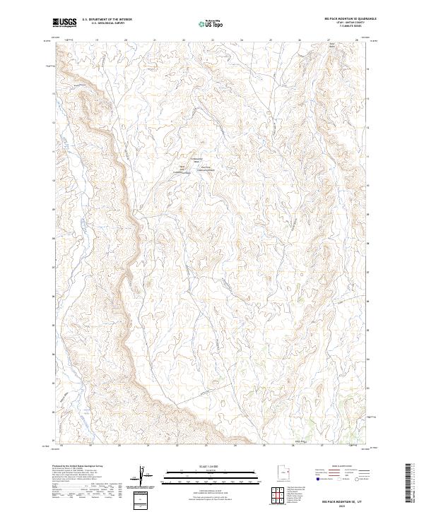
2023 Map of Big Pack Mountain SE
USGS Topo · Published 2023About this map
Willow Creek meanders through the western portion of this 2023 survey, serving as a primary drainage for the surrounding high plateau country. This landscape in Uintah County is defined by deeply incised drainages and expansive ridgelines, most notably Seep Ridge and the broad Flat Rock N in the southwest corner. The hydrology is centered around the Cottonwood Wash system, including its West Fork and East Fork, which carve through the central terrain. Remote access is provided by a network of utilitarian routes such as Seep Ridge Rd, W Sand Wash Rd, and the curiously named Wrong Way. A localized water source at Sulphur Spring and the passage of Agency Draw suggest a landscape where water and topography dictate the movement of both livestock and energy-related infrastructure common to the Uintah Basin.
Find a feature on this map
13 named features on this map. Tap any name to fly to it.
Don’t see what you’re looking for? This feature index may not catch every label — zoom into the map to look around manually.
Map Details
Editions of this 2023 Big Pack Mountain SE Map
This is the sole edition of this map. No revisions or reprints were ever made.
Other maps of this area

1885 · East Tavaputs
USGS Topo · 1:250,000

1956 · Grand Junction
USGS Topo · 1:250,000

1959 · Grand Junction
USGS Topo · 1:250,000

1960 · Grand Junction
USGS Topo · 1:250,000

1962 · Grand Junction
USGS Topo · 1:250,000

1964 · Grand Junction
USGS Topo · 1:250,000

1965 · Grand Junction
USGS Topo · 1:250,000

1966 · Bates Knolls
USGS Topo · 1:24,000
1966 · Agency Draw NE
USGS Topo · 1:24,000
1966 · Agency Draw NW
USGS Topo · 1:24,000