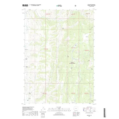
2017 Map of Big Park
USGS Topo · Published 2017About this map
Collett Flat sits at the edge of this high-elevation landscape in Lincoln County, where the topography is defined by the headwaters of the Dry Fork Smiths Fork. This 2017 survey reveals the intricate drainage patterns of the Wyoming Range, characterized by a complex network of canyons and high-altitude basins typical of the western slope of the Rockies. The map is a testament to the modern era of conservation and resource management, showing how the Forest Service and other agencies track the transition from private land to public domain. While many of the historic trails and minor names may have faded, the primary geographic markers like the fork of the river remain critical for navigating this remote corner of the Bridger National Forest.
Find a feature on this map
2 named features on this map. Tap any name to fly to it.
Don’t see what you’re looking for? This feature index may not catch every label — zoom into the map to look around manually.
Map Details
Editions of this 2017 Big Park Map
This is the sole edition of this map. No revisions or reprints were ever made.
Other maps of this area

1936 · Cokeville
USGS Topo · 1:96,000

1942 · Cokeville
USGS Topo · 1:125,000

1955 · Preston
USGS Topo · 1:250,000

1958 · Preston
USGS Topo · 1:250,000

1962 · Preston
USGS Topo · 1:250,000
1967 · Pole Creek
USGS Topo · 1:24,000

1967 · Devils Hole Creek
USGS Topo · 1:24,000

1967 · Graham Peak
USGS Topo · 1:24,000

1967 · Big Park
USGS Topo · 1:24,000

1967 · Huff Lake
USGS Topo · 1:24,000