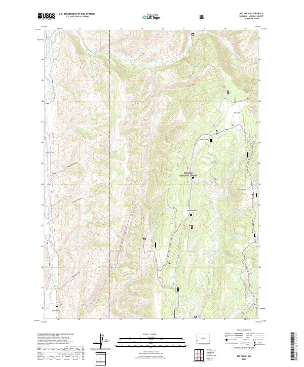
2021 Map of Big Park
USGS Topo · Published 2021About this map
Bridger National Forest land defines this section of the Tunp Range in western Wyoming, where the landscape transitions between high ridges and secluded meadow flats. The southern reaches of the map feature the Smith Fork Cem near Button Flat, a notable point of interest for genealogists tracing local families in the area. Waterways like the Smiths Fork and the W Fork Hams Fork drain the high country, following paths through family-named geography such as Japanese Park, Collett Flat, and Big Park. The presence of numerous trails, including the Nugent/Dry Fork Trl and the Big Park Loop Trl, suggests a history of forest access and range management through the steep drainages of Preacher Hollow and Bloom Hollow.
Find a feature on this map
46 named features on this map. Tap any name to fly to it.
Don’t see what you’re looking for? This feature index may not catch every label — zoom into the map to look around manually.
Map Details
Editions of this 2021 Big Park Map
This is the sole edition of this map. No revisions or reprints were ever made.
Other maps of this area

1936 · Cokeville
USGS Topo · 1:96,000

1942 · Cokeville
USGS Topo · 1:125,000

1955 · Preston
USGS Topo · 1:250,000

1958 · Preston
USGS Topo · 1:250,000

1962 · Preston
USGS Topo · 1:250,000
1967 · Pole Creek
USGS Topo · 1:24,000

1967 · Devils Hole Creek
USGS Topo · 1:24,000

1967 · Graham Peak
USGS Topo · 1:24,000

1967 · Big Park
USGS Topo · 1:24,000

1967 · Huff Lake
USGS Topo · 1:24,000