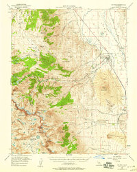
1950 Map of Big Pine
USGS Topo · Published 1958About this map
Big Pine Indian Rancheria and the town of Big Pine sit at the floor of the Owens Valley, serving as a gateway between the desert lowlands and the high peaks of the Sierra Nevada. This mid-century survey illustrates a landscape of extreme verticality, where the Owens River and the Southern Pacific railroad line at Zurich contrast with the glacial features of the west. Water management is a central theme of the valley floor, evidenced by the Big Pine Canal and the Powerhouse along Big Pine Creek.
Find a feature on this map
82 named features on this map. Tap any name to fly to it.
Don’t see what you’re looking for? This feature index may not catch every label — zoom into the map to look around manually.
Map Details
Editions of this 1950 Big Pine Map
5 editions found

Other maps of this area

1903 · Tehipite
USGS Topo · 1:125,000

1905 · Tehipite
USGS Topo · 1:125,000

1907 · Mt. Whitney
USGS Topo · 1:125,000

1912 · Mt. Goddard
USGS Topo · 1:125,000

1913 · Bishop
USGS Topo · 1:125,000

1919 · Mt. Whitney
USGS Topo · 1:125,000

1937 · Mt. Whitney
USGS Topo · 1:125,000

1947 · Mariposa
USGS Topo · 1:250,000

1948 · Fresno
USGS Topo · 1:250,000

1948 · Mariposa
USGS Topo · 1:250,000