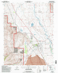
1994 Map of Big Pine
USGS Topo · Published 1997About this map
The Owens Valley landscape of the mid-1990s is defined by the sharp transition from the irrigated valley floor to the steep eastern slopes of the Inyo National Forest. Centered on the settlement of Big Pine, this survey illustrates a unique intersection of traditional land use and high-tech research, where the Big Pine Indian Reservation sits just miles from the massive radio telescopes of the Owens Valley Radio Observatory. The infrastructure of the era is remarkably detailed, tracing the winding path of Big Pine Creek as it feeds the Big Pine Canal and passes landmarks like the County Sanitorium and Inyo Heights High Sch. To the west, the topography rises sharply toward the Warren Bench, while the lowlands near Zurich are marked by extensive water management features, including Klondike Lake and various gaging stations along the Owens River.
Find a feature on this map
43 named features on this map. Tap any name to fly to it.
Don’t see what you’re looking for? This feature index may not catch every label — zoom into the map to look around manually.
Map Details
Editions of this 1994 Big Pine Map
This is the sole edition of this map. No revisions or reprints were ever made.
Other maps of this area

1913 · Bishop
USGS Topo · 1:125,000

1947 · Mariposa
USGS Topo · 1:250,000

1948 · Mariposa
USGS Topo · 1:250,000

1949 · Bishop
USGS Topo · 1:62,500

1950 · Big Pine
USGS Topo · 1:62,500

1951 · Bishop
USGS Topo · 1:62,500

1951 · Blanco Mountain
USGS Topo · 1:62,500

1951 · Waucoba Mtn.
USGS Topo · 1:62,500

1957 · Mariposa
USGS Topo · 1:250,000
1958 · Waucoba Mtn
USGS Topo · 1:62,500