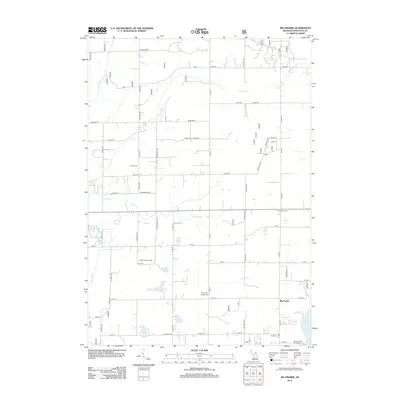
2012 Map of Big Prairie
USGS Topo · Published 2012About this map
Big Prairie sits at the heart of a landscape defined by its glacial hydrology and agricultural heritage in Newaygo County. The western portion of the quadrangle is etched by the courses of Mullen Cr, Fivemile Cr, and Flinton Cr, which flow through a mix of open fields and woodlands. Notable wetland features like Gustafson Marsh and Biddleman Marsh occupy the low-lying central areas, suggesting the complex drainage patterns of this township. The presence of the Amish Cem near E 1 Mile Rd and the Big Prairie Everett Cem further south provides significant touchpoints for genealogical research and local history.
Find a feature on this map
60 named features on this map. Tap any name to fly to it.
Don’t see what you’re looking for? This feature index may not catch every label — zoom into the map to look around manually.
Map Details
Editions of this 2012 Big Prairie Map
This is the sole edition of this map. No revisions or reprints were ever made.
Other maps of this area

1954 · Midland
USGS Topo · 1:250,000

1958 · Midland
USGS Topo · 1:250,000

1958 · Sand Lake
USGS Topo · 1:62,500

1958 · Fremont
USGS Topo · 1:62,500

1958 · Woodville
USGS Topo · 1:62,500

1959 · Midland
USGS Topo · 1:250,000

1959 · White Cloud
USGS Topo · 1:62,500

1966 · Midland
USGS Topo · 1:250,000

1976 · White Cloud SE
USGS Topo · 1:24,000
1976 · White Cloud NE
USGS Topo · 1:24,000