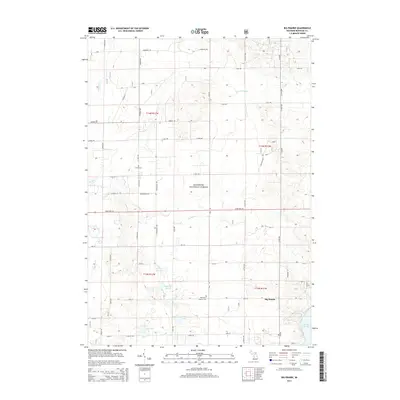
2014 Map of Big Prairie
USGS Topo · Published 2014About this map
Manistee National Forest covers much of this landscape, where the sandy soils of Big Prairie Township meet the water systems of the Muskegon River watershed. The settlement of Big Prairie is anchored by landmarks like the Big Prairie Everett Cem, while the Amish Cem reflects the distinct cultural history of the local community. The southern portion of the map is dominated by the sprawling waters of Hardy Dam Pond, a significant impoundment on the Muskegon River. The terrain is characterized by complex hydrology, including numerous marshes and creeks such as Gustafson Marsh, Biddleman Marsh, and the winding Fivemile Creek. Smaller interior lakes like Eaves Lake and Fry Lake are connected by minor drainages like Cold Cr and Flinton Cr, creating a diverse environment of woodland and wetlands.
Find a feature on this map
60 named features on this map. Tap any name to fly to it.
Don’t see what you’re looking for? This feature index may not catch every label — zoom into the map to look around manually.
Map Details
Editions of this 2014 Big Prairie Map
This is the sole edition of this map. No revisions or reprints were ever made.
Other maps of this area

1954 · Midland
USGS Topo · 1:250,000

1958 · Midland
USGS Topo · 1:250,000

1958 · Sand Lake
USGS Topo · 1:62,500

1958 · Fremont
USGS Topo · 1:62,500

1958 · Woodville
USGS Topo · 1:62,500

1959 · Midland
USGS Topo · 1:250,000

1959 · White Cloud
USGS Topo · 1:62,500

1966 · Midland
USGS Topo · 1:250,000

1976 · White Cloud SE
USGS Topo · 1:24,000
1976 · White Cloud NE
USGS Topo · 1:24,000