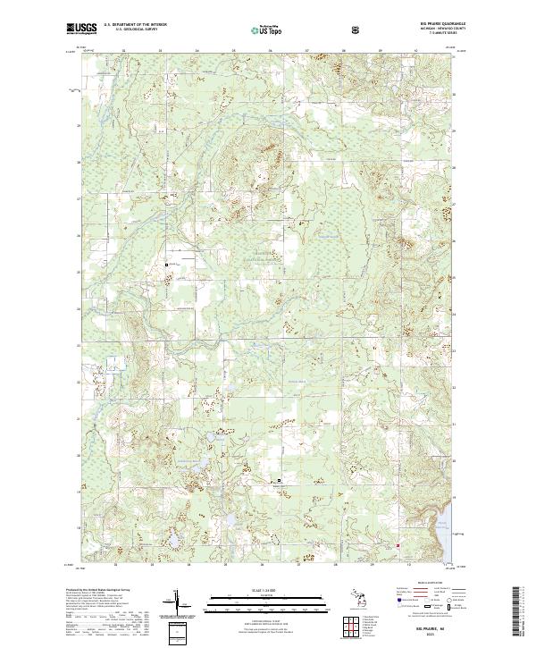
2023 Map of Big Prairie
USGS Topo · Published 2023About this map
Manistee National Forest lands dominate this portion of Newaygo County, where the transition between dense woodland and marshy lowlands defines the landscape. Genealogical interest is centered on the Amish Cem near Adams St and the Big Prairie - Everett Cem located along 20th St, providing critical markers for local family history research. The southern portion of the map is defined by significant water features including Hardy Dam Pond and the headwaters of Cold Creek, while the interior contains numerous named wetlands such as Gustafson Marsh and Dudgeon Swamp. The section-line road network, including Monroe Rd and Poplar Rd, illustrates the persistent township and range surveying pattern that organized Michigan's rural development into the twenty-first century.
Find a feature on this map
59 named features on this map. Tap any name to fly to it.
Don’t see what you’re looking for? This feature index may not catch every label — zoom into the map to look around manually.
Map Details
Editions of this 2023 Big Prairie Map
This is the sole edition of this map. No revisions or reprints were ever made.
Other maps of this area

1954 · Midland
USGS Topo · 1:250,000

1958 · Midland
USGS Topo · 1:250,000

1958 · Sand Lake
USGS Topo · 1:62,500

1958 · Fremont
USGS Topo · 1:62,500

1958 · Woodville
USGS Topo · 1:62,500

1959 · Midland
USGS Topo · 1:250,000

1959 · White Cloud
USGS Topo · 1:62,500

1966 · Midland
USGS Topo · 1:250,000

1976 · White Cloud SE
USGS Topo · 1:24,000
1976 · White Cloud NE
USGS Topo · 1:24,000