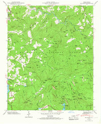
1946 Map of Big Ridge
USGS Topo · Published 1968About this map
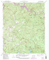
Tuckasegee River headwaters dominate this high-elevation terrain within the Nantahala National Forest, where the complex drainage patterns of the Blue Ridge are intricately documented. Small pockets of human presence appear at Indian Place and the Morrie Woods Camp, while the Rock Bridge Sch provides a rare marker of established community infrastructure in the remote highlands. The landscape is defined by its water, from the engineered Thorpe Reservoir and Fairfield Lake to numerous natural cascades like Schoolhouse Falls and Maidenhair Falls. Significant topographical features such as Double Mountain and the steep Dillard Canyon shape the movement of the Horsepasture River as it flows south. This survey, completed shortly after the war, captures the transition of the region from a purely wilderness timberland toward one featuring managed reservoirs and early recreational camps.
Find a feature on this map
156 named features on this map. Tap any name to fly to it.
Don’t see what you’re looking for? This feature index may not catch every label — zoom into the map to look around manually.
Map Details
Editions of this 1946 Big Ridge Map
5 editions found
Other maps of this area

1891 · Cowee
USGS Topo · 1:125,000

1897 · Cowee
USGS Topo · 1:125,000

1905 · Pisgah
USGS Topo · 1:125,000

1906 · Pisgah
USGS Topo · 1:125,000

1907 · Cowee
USGS Topo · 1:125,000

1935 · Sam Knob
USGS Topo · 1:24,000

1935 · Cashiers
USGS Topo · 1:24,000

1935 · Tuckaseigee
USGS Topo · 1:24,000

1935 · Lake Toxaway
USGS Topo · 1:24,000

1935 · Reid
USGS Topo · 1:24,000