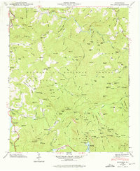
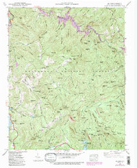
1946 Map of Big Ridge
USGS Topo · Published 1975About this map
Nantahala National Forest dominates this topographic survey of Jackson County, showcasing a complex network of ridges and watercourses immediately following World War II. The landscape is defined by the Tuckasegee River and its west fork, which carve through dramatic terrain features like Bonas Defeat and The Dismal. Small mountain communities and family settlements are marked by landmarks such as the Big Ridge Ch and the Rock Bridge Sch, reflecting the rural character of the Blue Ridge highlands during this era.
Find a feature on this map
156 named features on this map. Tap any name to fly to it.
Don’t see what you’re looking for? This feature index may not catch every label — zoom into the map to look around manually.
Map Details
Editions of this 1946 Big Ridge Map
5 editions found
Other maps of this area

1891 · Cowee
USGS Topo · 1:125,000

1897 · Cowee
USGS Topo · 1:125,000

1905 · Pisgah
USGS Topo · 1:125,000

1906 · Pisgah
USGS Topo · 1:125,000

1907 · Cowee
USGS Topo · 1:125,000

1935 · Sam Knob
USGS Topo · 1:24,000

1935 · Cashiers
USGS Topo · 1:24,000

1935 · Tuckaseigee
USGS Topo · 1:24,000

1935 · Lake Toxaway
USGS Topo · 1:24,000

1935 · Reid
USGS Topo · 1:24,000