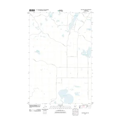
2011 Map of Big Rush Lake
USGS Topo · Published 2011About this map
Big Rush Lake and a dense network of glacial basins define this Becker County landscape. In this 2011 survey, the area is characterized by scattered recreational and residential development concentrated along water bodies like Bad Medicine Lake and Lake Wahbegon. The road system is a mix of established county routes and more informal pathways, such as the Old Many Pt Trl and Bunker Hill Rd, which provide access to isolated points of interest like Camp Seven Lake. The terrain is marked by significant hydrological diversity, with smaller features like Kneebone Lake, Bass Lake, and Mud Lake interspersed between larger lakes. This pattern suggests a landscape shaped by glacial activity where modern settlement follows the contours of the shoreline, while the interior remains largely defined by the grid of local roads and natural drainage.
Find a feature on this map
27 named features on this map. Tap any name to fly to it.
Don’t see what you’re looking for? This feature index may not catch every label — zoom into the map to look around manually.
Map Details
Editions of this 2011 Big Rush Lake Map
This is the sole edition of this map. No revisions or reprints were ever made.
Other maps of this area

1953 · Brainerd
USGS Topo · 1:250,000

1954 · Bemidji
USGS Topo · 1:250,000

1957 · Brainerd
USGS Topo · 1:250,000

1957 · Bemidji
USGS Topo · 1:250,000

1958 · Bemidji
USGS Topo · 1:250,000

1958 · Brainerd
USGS Topo · 1:250,000

1959 · Height Of Land Lake
USGS Topo · 1:24,000

1965 · Brainerd
USGS Topo · 1:250,000

1969 · Many Point Lake
USGS Topo · 1:24,000

1969 · Tulaby Lake
USGS Topo · 1:24,000