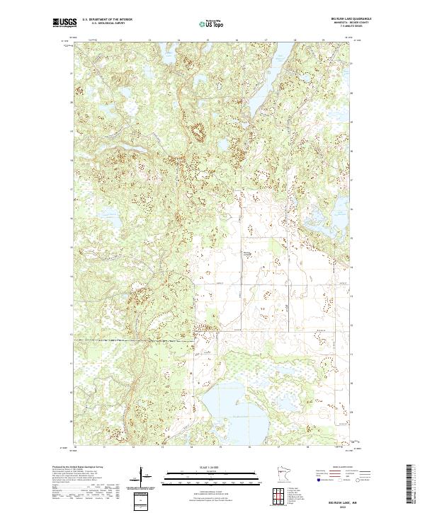
2022 Map of Big Rush Lake
USGS Topo · Published 2022About this map
Big Rush Lake and its surrounding glacial wetlands dominate this Becker County landscape, illustrating a complex network of waterways and modern trail systems. The North Country National Scenic Trl winds through the central corridor, intersecting a grid of rural routes like Co Rd 58 and 330th St. In the northern section, deep-water features including Bad Medicine Lake and Juggler Lake are surrounded by a high density of local access roads such as Many Point Scout Camp Rd and Elbow Lake Rd. An interesting aviation landmark, Rooney Airfield, sits nestled between the forests and Lake Wahbegon, providing a specific point of interest for researchers tracking local transportation infrastructure and small-scale land use in this lake-rich region of Minnesota.
Find a feature on this map
27 named features on this map. Tap any name to fly to it.
Don’t see what you’re looking for? This feature index may not catch every label — zoom into the map to look around manually.
Map Details
Editions of this 2022 Big Rush Lake Map
This is the sole edition of this map. No revisions or reprints were ever made.
Other maps of this area

1953 · Brainerd
USGS Topo · 1:250,000

1954 · Bemidji
USGS Topo · 1:250,000

1957 · Brainerd
USGS Topo · 1:250,000

1957 · Bemidji
USGS Topo · 1:250,000

1958 · Bemidji
USGS Topo · 1:250,000

1958 · Brainerd
USGS Topo · 1:250,000

1959 · Height Of Land Lake
USGS Topo · 1:24,000

1965 · Brainerd
USGS Topo · 1:250,000

1969 · Many Point Lake
USGS Topo · 1:24,000

1969 · Tulaby Lake
USGS Topo · 1:24,000