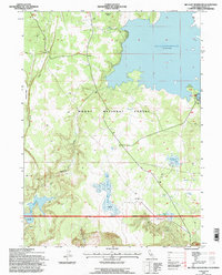
1993 Map of Big Sage Reservoir
USGS Topo · Published 1997About this map
Modoc National Forest dominates this high-altitude landscape, where the massive Big Sage Reservoir serves as a focal point for water management and recreation in the high desert. The map shows the infrastructure supporting the reservoir, including the Big Sage Dam and a Boat Ramp, alongside smaller water bodies like Kelley Reservoir and Essex Reservoir. This 1993 revision, based on photographs dating back to 1958, illustrates a land utilized for both conservation and resource extraction, evidenced by the Devils Garden Conservation Camp and scattered sites like a Pit and Prospect near Salisbury Gulch. The network of 4wd tracks and trails connecting Whittemore Ridge and Porcupine Valley highlights the area's role as a managed wilderness area where natural springs such as Mill Springs and Rock Springs remain vital landmarks in an otherwise arid terrain.
Find a feature on this map
24 named features on this map. Tap any name to fly to it.
Don’t see what you’re looking for? This feature index may not catch every label — zoom into the map to look around manually.
Map Details
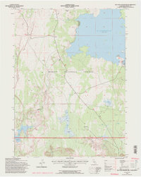
Editions of this 1993 Big Sage Reservoir Map
2 editions found
Other maps of this area

1886 · Alturas
USGS Topo · 1:250,000

1892 · Alturas
USGS Topo · 1:250,000

1954 · Alturas
USGS Topo · 1:250,000

1958 · Alturas
USGS Topo · 1:250,000

1961 · Canby
USGS Topo · 1:62,500

1961 · Alturas
USGS Topo · 1:62,500

1962 · Alturas
USGS Topo · 1:250,000

1962 · Big Sage Reservoir
USGS Topo · 1:62,500

1962 · Jacks Butte
USGS Topo · 1:62,500

1965 · Alturas
USGS Topo · 1:250,000