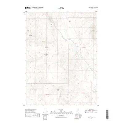
2018 Map of Big Sawmill Canyon
USGS Topo · Published 2018About this map
Big Sawmill Canyon and the high desert terrain of northern Washoe County are documented in this contemporary survey, showing a landscape defined by seasonal drainages and vital water sources. The map reveals the critical importance of localized hydraulics in this arid region, from the clustered Wood Road Reservoirs to isolated points like Table Spring and Antelope Spring. This network of springs suggests a legacy of livestock grazing and land management across the complex geography of Poodle Mountain Canyon and Crutcher Canyon. Elevated features such as Granite Mtn look out over the Squaw Creek Valley, while the meandering course of Squaw Cr provides a primary corridor through the northern sections of the quadrangle. The lack of permanent settlements emphasizes the vast, undeveloped nature of these township boundaries in the 21st century.
Find a feature on this map
23 named features on this map. Tap any name to fly to it.
Don’t see what you’re looking for? This feature index may not catch every label — zoom into the map to look around manually.
Map Details
Editions of this 2018 Big Sawmill Canyon Map
This is the sole edition of this map. No revisions or reprints were ever made.
Other maps of this area

1886 · Granite Range
USGS Topo · 1:250,000

1894 · Granite Range
USGS Topo · 1:250,000

1955 · Lovelock
USGS Topo · 1:250,000

1959 · Lovelock
USGS Topo · 1:250,000

1964 · Gerlach
USGS Topo · 1:62,500

1980 · Melody Mountain
USGS Topo · 1:24,000
1980 · The Banjo
USGS Topo · 1:24,000

1980 · Wall Spring
USGS Topo · 1:24,000
1981 · Squaw Valley
USGS Topo · 1:24,000
1981 · Crutcher Canyon
USGS Topo · 1:24,000