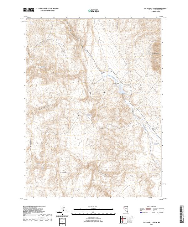
2023 Map of Big Sawmill Canyon
USGS Topo · Published 2023About this map
Smoke Creek Valley Opening defines the central topography of this Great Basin landscape, where the high desert terrain of Washoe County is marked by a complex network of seasonal water sources and steep canyons. The drainage patterns are anchored by Deep Hole Spring Creek and Clear Creek, while several isolated upland springs, including Antelope Spring and Trail Canyon Spring Number One, suggest the historical importance of reliable water in this arid environment. Significant vertical relief is provided by Granite Mountain and Poodle Mountain, framing the broad Big Sawmill Basin. Remote infrastructure is minimal, represented primarily by S R 447 and the Wood Road Reservoirs, which illustrate the region's long-standing reliance on managed water for ranching or land management in the shadow of the Rainbow Hills.
Find a feature on this map
32 named features on this map. Tap any name to fly to it.
Don’t see what you’re looking for? This feature index may not catch every label — zoom into the map to look around manually.
Map Details
Editions of this 2023 Big Sawmill Canyon Map
This is the sole edition of this map. No revisions or reprints were ever made.
Other maps of this area

1886 · Granite Range
USGS Topo · 1:250,000

1894 · Granite Range
USGS Topo · 1:250,000

1955 · Lovelock
USGS Topo · 1:250,000

1959 · Lovelock
USGS Topo · 1:250,000

1964 · Gerlach
USGS Topo · 1:62,500

1980 · Melody Mountain
USGS Topo · 1:24,000
1980 · The Banjo
USGS Topo · 1:24,000

1980 · Wall Spring
USGS Topo · 1:24,000
1981 · Squaw Valley
USGS Topo · 1:24,000
1981 · Crutcher Canyon
USGS Topo · 1:24,000