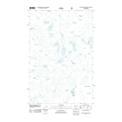
2011 Map of Big Snow Mountain
USGS Topo · Published 2011About this map
Big Snow Mountain and the high peaks of the Cascade Range dominate this 2011 survey, where the drainages of the Middle Fork Snoqualmie River and West Fork Foss River carve through a landscape of alpine lakes and glaciated valleys. The area is defined by its extreme verticality, featuring landmarks such as Iron Cap Mountain, Overcoat Peak, and the distinctive Chimney Rock. High-elevation basins contain numerous named water bodies including Big Heart Lake, Angeline Lake, and the cluster known as the Necklace Valley Lakes within the Necklace Valley. These features illustrate the complex hydrography of the region, where Malachite Falls feeds into Lake Malachite and seasonal meltwater fills basins like Jewel Lake and Jade Lake. Only a single primitive road, NF-5620 RD, touches the southwestern corner, emphasizing the roadless character of this mountain terrain in the early 21st century.
Find a feature on this map
55 named features on this map. Tap any name to fly to it.
Don’t see what you’re looking for? This feature index may not catch every label — zoom into the map to look around manually.
Map Details
Editions of this 2011 Big Snow Mountain Map
This is the sole edition of this map. No revisions or reprints were ever made.
Other maps of this area

1901 · Snoqualmie Pass
USGS Topo · 1:125,000

1902 · Skykomish
USGS Topo · 1:125,000

1903 · Snoqualmie
USGS Topo · 1:125,000

1905 · Skykomish
USGS Topo · 1:125,000

1957 · Wenatchee
USGS Topo · 1:250,000

1961 · Snoqualmie Pass
USGS Topo · 1:62,500

1961 · Kachess Lake
USGS Topo · 1:62,500

1965 · Grotto
USGS Topo · 1:24,000

1965 · Mount Daniel
USGS Topo · 1:24,000

1965 · Skykomish
USGS Topo · 1:24,000