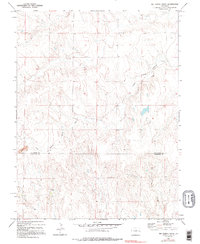
1979 Map of Big Spring Creek
USGS Topo · Published 1995About this map
High plains drainage patterns define the borderlands between Kit Carson Co and Cheyenne Co during the late 1970s. This survey, based on aerial photography from 1973, reveals a landscape dominated by the seasonal waterways of the East Branch Big Spring Creek and Post Creek. The topography is characterized by intricate drainage channels and draws that cut through the undulating terrain, indicating the erosional forces at work in this part of eastern Colorado.
Find a feature on this map
5 named features on this map. Tap any name to fly to it.
Don’t see what you’re looking for? This feature index may not catch every label — zoom into the map to look around manually.
Map Details
Editions of this 1979 Big Spring Creek Map
3 editions found
Other maps of this area

1891 · Arroyo
USGS Topo · 1:125,000

1891 · Kit Carson
USGS Topo · 1:125,000

1893 · Arroyo
USGS Topo · 1:125,000

1893 · Kit Carson
USGS Topo · 1:125,000

1954 · Limon
USGS Topo · 1:250,000

1954 · Lamar
USGS Topo · 1:250,000

1957 · Limon
USGS Topo · 1:250,000

1958 · Limon
USGS Topo · 1:250,000

1958 · Lamar
USGS Topo · 1:250,000

1978 · Sanders Ranch
USGS Topo · 1:24,000