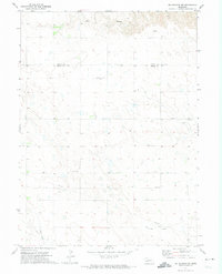
1971 Map of Big Springs NW
USGS Topo · Published 1974About this map
The high plains of the Nebraska Panhandle are captured here during the early 1970s, where the landscape is defined by the dramatic incision of Ash Hollow into the tableland. This area, spanning the border of Garden and Deuel Counties, shows a rural economy centered on ranching and emerging energy infrastructure. The presence of a Landing Strip and a separate Landing Field suggests the necessity of light aircraft for managing these expansive properties.
Find a feature on this map
14 named features on this map. Tap any name to fly to it.
Don’t see what you’re looking for? This feature index may not catch every label — zoom into the map to look around manually.
Map Details
Editions of this 1971 Big Springs NW Map
This is the sole edition of this map. No revisions or reprints were ever made.
Other maps of this area

1900 · Chappell
USGS Topo · 1:125,000

1954 · Scottsbluff
USGS Topo · 1:250,000

1958 · Scottsbluff
USGS Topo · 1:250,000

1961 · Barton
USGS Topo · 1:24,000

1961 · Big Springs
USGS Topo · 1:24,000

1961 · Chappell SE
USGS Topo · 1:24,000
1971 · Big Springs NE
USGS Topo · 1:24,000
1971 · Ruthton
USGS Topo · 1:24,000

1971 · Barn Butte
USGS Topo · 1:24,000

1971 · Chappell NE
USGS Topo · 1:24,000