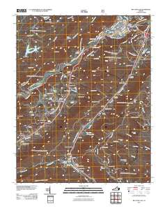
2011 Map of Big Stone Gap
USGS Topo · Published 2011About this map
Big Stone Gap sits at the confluence of the South Fork Powell River and the Powell River, a landscape defined by the drainage of Stone Mountain and the gaps that cut through the ridges. The 2011 survey reveals a complex network of family and community cemeteries, such as the Glencoe Cemetery and Gilly Cemetery, which offer valuable data for genealogists tracing regional heritage. The area is marked by distinctive topographical features like Olinger Gap and Wildcat Summit, while water management is evidenced by the Lake Keokee Dam and the crossing at Hugh Williams Memorial Bridge.
Find a feature on this map
113 named features on this map. Tap any name to fly to it.
Don’t see what you’re looking for? This feature index may not catch every label — zoom into the map to look around manually.
Map Details
Editions of this 2011 Big Stone Gap Map
This is the sole edition of this map. No revisions or reprints were ever made.
Other maps of this area

1894 · Estillville
USGS Topo · 1:125,000

1920 · Wise
USGS Topo · 1:48,000

1921 · Big Stone Gap
USGS Topo · 1:48,000

1921 · Wise
USGS Topo · 1:62,500

1922 · Big Stone Gap
USGS Topo · 1:62,500

1929 · Big Stone Gap
USGS Topo · 1:62,500

1935 · Moggasin
USGS Topo · 1:48,000
1935 · Norton
USGS Topo · 1:24,000
1935 · Appalachia
USGS Topo · 1:24,000

1935 · East Stone Gap
USGS Topo · 1:24,000