
1986 Map of Big Wall NW
USGS Topo · Published 1986About this map
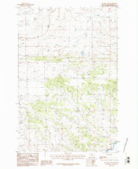
Little Wall Creek and Crooked Creek carve through this section of central Montana, which straddles the border of Petroleum Co and Musselshell Co. The terrain is defined by the broad topographic depression of the Devils Basin, a significant landform for local ranchers and geologists alike. This 1986 provisional edition, based on field checks from the late 1970s, captures a sparsely settled landscape where human activity is limited to a few specific utilitarian sites. Functional landmarks such as a Gravel Pit, a Corral, and a single irrigation Ditch point to the area's primary use for livestock grazing and road maintenance. The intricate contour work illustrates the complex drainage patterns of the high plains, showing the transition between the dry upland basins and the creek valleys.
Find a feature on this map
7 named features on this map. Tap any name to fly to it.
Don’t see what you’re looking for? This feature index may not catch every label — zoom into the map to look around manually.
Map Details
Editions of this 1986 Big Wall NW Map
This is the sole edition of this map. No revisions or reprints were ever made.
Other maps of this area

1954 · Roundup
USGS Topo · 1:250,000

1958 · Roundup
USGS Topo · 1:250,000

1986 · Lake Mason SE
USGS Topo · 1:24,000

1986 · Lake Mason NE
USGS Topo · 1:24,000

1986 · Flatwillow
USGS Topo · 1:24,000

1986 · Pike Creek Hills East
USGS Topo · 1:24,000

1986 · Crowley Dam
USGS Topo · 1:24,000

1986 · Big Wall West
USGS Topo · 1:24,000
1986 · Big Wall East
USGS Topo · 1:24,000
1986 · Jim Coulee
USGS Topo · 1:24,000
Featured Places
- Sunset Hutterite Colony, MT
- Flatwillow Hutterite Colony, MT
- Petroleum County, MT
- Musselshell County, MT
- United States