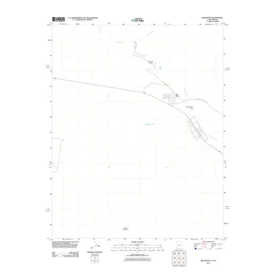
2011 Map of Big Water
USGS Topo · Published 2011About this map
Big Water sits at the intersection of arid canyonlands and high plateaus in this modern topographic study of southern Kane County. The town is situated along 89, serving as a gateway to the neighboring Glen Canyon National Park. The landscape is defined by its drainage systems, featuring the prominent Wahweap Creek and seasonal watercourses such as Nipple Creek and Coyote Creek.
Find a feature on this map
11 named features on this map. Tap any name to fly to it.
Don’t see what you’re looking for? This feature index may not catch every label — zoom into the map to look around manually.
Map Details
Editions of this 2011 Big Water Map
This is the sole edition of this map. No revisions or reprints were ever made.
Other maps of this area

1886 · Escalante
USGS Topo · 1:250,000

1886 · Echo Cliffs
USGS Topo · 1:250,000

1891 · Echo Cliffs
USGS Topo · 1:250,000

1951 · Lees Ferry NE
USGS Topo · 1:24,000

1953 · Nipple Butte
USGS Topo · 1:62,500

1954 · Lees Ferry NW
USGS Topo · 1:24,000

1954 · Lees Ferry
USGS Topo · 1:62,500
1954 · Paria Plateau
USGS Topo · 1:62,500

1954 · Paria
USGS Topo · 1:62,500

1956 · Escalante
USGS Topo · 1:250,000