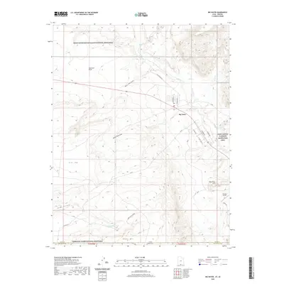
2020 Map of Big Water
USGS Topo · Published 2020About this map
Big Water sits at a geographic crossroads in southern Kane County, where the desert landscape meets federal conservation lands. The settlement is positioned near the intersection of Highway 89 and local routes like Victory Way, serving as a gateway between three major protected areas. The map illustrates how the town is hemmed in by the Grand Staircase-Escalante National Monument to the north and the Vermilion Cliffs National Monument to the south.
Find a feature on this map
32 named features on this map. Tap any name to fly to it.
Don’t see what you’re looking for? This feature index may not catch every label — zoom into the map to look around manually.
Map Details
Editions of this 2020 Big Water Map
This is the sole edition of this map. No revisions or reprints were ever made.
Other maps of this area

1886 · Escalante
USGS Topo · 1:250,000

1886 · Echo Cliffs
USGS Topo · 1:250,000

1891 · Echo Cliffs
USGS Topo · 1:250,000

1951 · Lees Ferry NE
USGS Topo · 1:24,000

1953 · Nipple Butte
USGS Topo · 1:62,500

1954 · Lees Ferry NW
USGS Topo · 1:24,000

1954 · Lees Ferry
USGS Topo · 1:62,500
1954 · Paria Plateau
USGS Topo · 1:62,500

1954 · Paria
USGS Topo · 1:62,500

1956 · Escalante
USGS Topo · 1:250,000