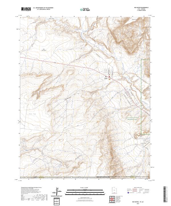
2023 Map of Big Water
USGS Topo · Published 2023About this map
Big Water sits at a crossroads of the high desert, positioned where US Highway 89 transitions into the expansive Glen Canyon National Recreation Area. The landscape is defined by dramatic geological features such as the Flat Top mesa and Cedar Mtn, while the drainage of Wahweap Creek and Chitum Wash shape the arid terrain. The area's status as a gateway to the backcountry is evident in the network of routes like the Smoky Mountain Road Trl and Fish Hatchery Rd, which reach into the northern reaches of the Paria Canyon-Vermilion Cliffs Wilderness. Evidence of local development and naming conventions appears in the town's street names, such as Ethan Allen and Aaron Burr, while outlying landmarks like the Larkspur Airstrip and Blue Pools Arch highlight the region's recreational and navigational importance near the Arizona border.
Find a feature on this map
35 named features on this map. Tap any name to fly to it.
Don’t see what you’re looking for? This feature index may not catch every label — zoom into the map to look around manually.
Map Details
Editions of this 2023 Big Water Map
This is the sole edition of this map. No revisions or reprints were ever made.
Other maps of this area

1886 · Escalante
USGS Topo · 1:250,000

1886 · Echo Cliffs
USGS Topo · 1:250,000

1891 · Echo Cliffs
USGS Topo · 1:250,000

1951 · Lees Ferry NE
USGS Topo · 1:24,000

1953 · Nipple Butte
USGS Topo · 1:62,500

1954 · Lees Ferry NW
USGS Topo · 1:24,000

1954 · Lees Ferry
USGS Topo · 1:62,500
1954 · Paria Plateau
USGS Topo · 1:62,500

1954 · Paria
USGS Topo · 1:62,500

1956 · Escalante
USGS Topo · 1:250,000