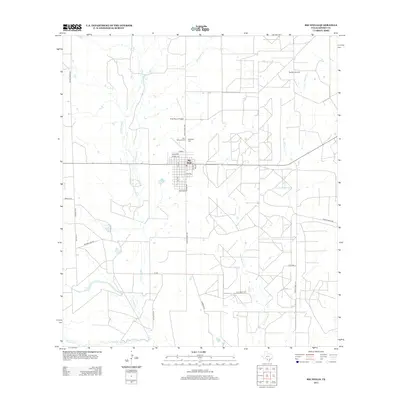
2013 Map of Big Wells
USGS Topo · Published 2013About this map
Big Wells serves as the central hub of this South Texas landscape, where the local street grid intersects with Ranch Road 1867. The surrounding terrain is defined by a network of drainage systems, including Arroyo Negro, Galuañeño Cr, and Sauz Mocho Cr, which lead toward the Nueces River along the southern boundary. This area reflects a long-standing ranching and energy economy, illustrated by the Big Wells Oil Field to the northeast and private aviation facilities like Price Ranch Airport. Local genealogy is anchored by sites such as Saint Michaels Cem and Big Wells Cem. The presence of Encina Lake and the winding course of Tortuga Cr further highlight the importance of water management and natural resources in this arid Dimmit County environment during the early 21st century.
Find a feature on this map
35 named features on this map. Tap any name to fly to it.
Don’t see what you’re looking for? This feature index may not catch every label — zoom into the map to look around manually.
Map Details
Editions of this 2013 Big Wells Map
This is the sole edition of this map. No revisions or reprints were ever made.
Other maps of this area

1925 · San Roque Lake 1-a
USGS Topo · 1:48,000

1927 · Bart
USGS Topo · 1:62,500

1929 · Cotulla
USGS Topo · 1:125,000

1932 · Valley Wells
USGS Topo · 1:62,500

1939 · Big Wells
USGS Topo · 1:62,500

1940 · Catarina
USGS Topo · 1:62,500

1940 · Artesia Wells
USGS Topo · 1:62,500

1953 · Crystal City
USGS Topo · 1:250,000

1955 · Crystal City
USGS Topo · 1:250,000

1956 · Woodward
USGS Topo · 1:62,500