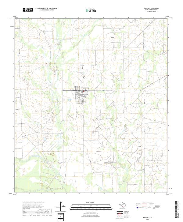
2022 Map of Big Wells
USGS Topo · Published 2022About this map
The community of Big Wells serves as a central hub in Dimmit County, defined by a grid of streets bearing state names such as Kansas, Nebraska, and Tennessee Ave. This 2022 survey captures the settlement near the northern reach of the Nueces River, where the landscape is carved by a network of drainage systems including Arroyo Negro and Galuañeno Cr. Two notable burial sites, Saint Michaels Cem and Big Wells Cem, sit just north of the town center along Ranch Rd 1867.
Find a feature on this map
49 named features on this map. Tap any name to fly to it.
Don’t see what you’re looking for? This feature index may not catch every label — zoom into the map to look around manually.
Map Details
Editions of this 2022 Big Wells Map
This is the sole edition of this map. No revisions or reprints were ever made.
Other maps of this area

1925 · San Roque Lake 1-a
USGS Topo · 1:48,000

1927 · Bart
USGS Topo · 1:62,500

1929 · Cotulla
USGS Topo · 1:125,000

1932 · Valley Wells
USGS Topo · 1:62,500

1939 · Big Wells
USGS Topo · 1:62,500

1940 · Catarina
USGS Topo · 1:62,500

1940 · Artesia Wells
USGS Topo · 1:62,500

1953 · Crystal City
USGS Topo · 1:250,000

1955 · Crystal City
USGS Topo · 1:250,000

1956 · Woodward
USGS Topo · 1:62,500