
1970 Map of Bill 4 SE
USGS Topo · Published 1973About this map
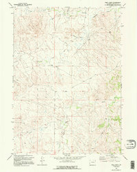
Moore Ranch anchors this high plains landscape in Converse County, where the topography is defined by an intricate network of drainage systems. The water economy of the early 1970s is evident through multiple labels for Flowing Wells and a specifically marked Oil Well, illustrating the reliance on both natural springs and industrial extraction. Significant watercourses such as Box Creek, Lightning Creek, and Walker Creek carve through the terrain, providing essential landmarks for ranching operations. The presence of a remote Landing Strip near the center of the map highlights the vast distances and the importance of aerial access in this corner of Wyoming. This map captures a specific moment in the rural development of the region, showing the intersection of traditional land use and the infrastructure of the energy industry.
Find a feature on this map
13 named features on this map. Tap any name to fly to it.
Don’t see what you’re looking for? This feature index may not catch every label — zoom into the map to look around manually.
Map Details
Editions of this 1970 Bill 4 SE Map
2 editions found
Other maps of this area

1954 · Torrington
USGS Topo · 1:250,000

1955 · Newcastle
USGS Topo · 1:250,000

1958 · Torrington
USGS Topo · 1:250,000

1958 · Newcastle
USGS Topo · 1:250,000

1970 · Walker Creek School
USGS Topo · 1:24,000

1970 · Bill 4 NW
USGS Topo · 1:24,000

1970 · Lost Springs NW
USGS Topo · 1:24,000
1970 · Bill 4 SW
USGS Topo · 1:24,000
1970 · Simpson Draw NW
USGS Topo · 1:24,000

1970 · Bill 4 NE
USGS Topo · 1:24,000