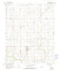
1968 Map of Billings
USGS Topo · Published 1991About this map
Billings stands at the center of this landscape, a settlement whose grid and infrastructure reflect the mid-century intersection of agriculture and energy. The town is flanked by two prominent burial sites, Sacred Heart Cem to the north and Billings Union Cem to the south, providing clear reference points for genealogical research. The Chicago Rock Island and Pacific railroad cuts a diagonal line across the northern half of the quadrangle, passing through the small station at Alcorn.
Find a feature on this map
26 named features on this map. Tap any name to fly to it.
Don’t see what you’re looking for? This feature index may not catch every label — zoom into the map to look around manually.
Map Details
Editions of this 1968 Billings Map
2 editions found
Other maps of this area

1955 · Enid
USGS Topo · 1:250,000

1956 · Garber
USGS Topo · 1:62,500

1958 · Enid
USGS Topo · 1:250,000

1968 · Lamont SE
USGS Topo · 1:24,000

1968 · Billings
USGS Topo · 1:24,000

1968 · Tonkawa SE
USGS Topo · 1:24,000

1968 · Eddy
USGS Topo · 1:24,000

1968 · Tonkawa
USGS Topo · 1:24,000

1968 · Lamont
USGS Topo · 1:24,000

1972 · Perry NW
USGS Topo · 1:24,000