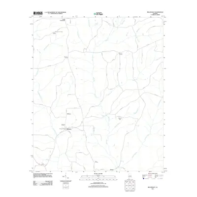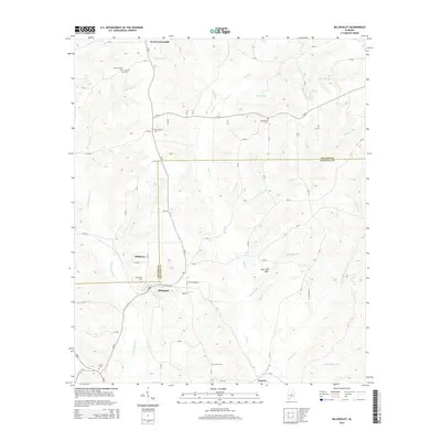
2024 Map of Billingsley
USGS Topo · Published 2024About this map
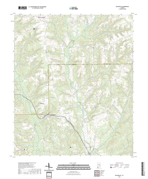
Billingsley sits at the intersection of local history and geology where the Fall Line Hills transition across the Autauga and Chilton County line. This survey documents a landscape defined by its cemeteries and watercourses, reflecting the deep-rooted settlement patterns of central Alabama. From Pools Crossroads in the north to Haynes in the south, the map traces the intricate drainage of Swift Creek and its many tributaries like Bee Branch and Cowwild Branch. Genealogists will find significant value in the distribution of family and community burial grounds, including New Antioch Cem, Harmony Cem, and New Cedron Cem. The presence of Billingsley Cem and Hinton Cem further underscores the genealogical wealth of this rural corridor. The road network, including Co RD 34 and Church St, reveals the slow evolution of these small crossroads communities through the decades.
Find a feature on this map
69 named features on this map. Tap any name to fly to it.
Don’t see what you’re looking for? This feature index may not catch every label — zoom into the map to look around manually.
Map Details
Editions of this 2024 Billingsley Map
This is the sole edition of this map. No revisions or reprints were ever made.
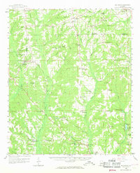
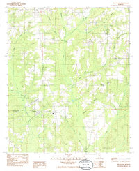
Historical Maps of Billingsley Through Time
7 maps found