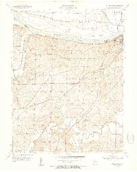
1953 Map of Billingsville
USGS Topo · Published 1954About this map
The Missouri River defines the northern edge of this mid-century landscape, where river commerce meets the inland rail networks of the Missouri Pacific and Missouri Kansas Texas railroads. The city of Boonville serves as the regional anchor, featuring its Waterworks, Fairground, and a Drive-in Theater that reflects the post-war era's changing recreation habits. South of the river, the terrain transitions into the agricultural uplands of Pilot Grove and Palestine, characterized by a network of rural schools and churches that once anchored these farming communities.
Find a feature on this map
44 named features on this map. Tap any name to fly to it.
Don’t see what you’re looking for? This feature index may not catch every label — zoom into the map to look around manually.
Map Details
Editions of this 1953 Billingsville Map
3 editions found
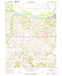
Other maps of this area

1888 · Boonville
USGS Topo · 1:125,000

1890 · Glasgow
USGS Topo · 1:125,000

1947 · Glasgow
USGS Topo · 1:62,500

1947 · Jefferson City
USGS Topo · 1:250,000

1952 · Boonville
USGS Topo · 1:24,000

1952 · New Franklin
USGS Topo · 1:24,000

1952 · Lone Elm
USGS Topo · 1:24,000

1953 · Moberly
USGS Topo · 1:250,000

1953 · Billingsville
USGS Topo · 1:24,000

1953 · Pilot Grove North
USGS Topo · 1:24,000