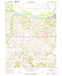
1953 Map of Billingsville
USGS Topo · Published 1979About this map
The Missouri River and Lamine River converge in this mid-century portrait of Cooper County, where river-bottom agriculture and rail transport dictated the local economy. The landscape is defined by its drainage systems, including the complex network of Petite Saline Creek and various branches like Hickory Branch and Lick Creek. Higher ground is dotted with rural social hubs, including the Billingsville Sch and Clear Spring Sch, which served as anchors for the surrounding farming communities.
Find a feature on this map
45 named features on this map. Tap any name to fly to it.
Don’t see what you’re looking for? This feature index may not catch every label — zoom into the map to look around manually.
Map Details
Editions of this 1953 Billingsville Map
3 editions found
Other maps of this area

1888 · Boonville
USGS Topo · 1:125,000

1890 · Glasgow
USGS Topo · 1:125,000

1947 · Glasgow
USGS Topo · 1:62,500

1947 · Jefferson City
USGS Topo · 1:250,000

1952 · Boonville
USGS Topo · 1:24,000

1952 · New Franklin
USGS Topo · 1:24,000

1952 · Lone Elm
USGS Topo · 1:24,000

1953 · Moberly
USGS Topo · 1:250,000

1953 · Billingsville
USGS Topo · 1:24,000

1953 · Pilot Grove North
USGS Topo · 1:24,000