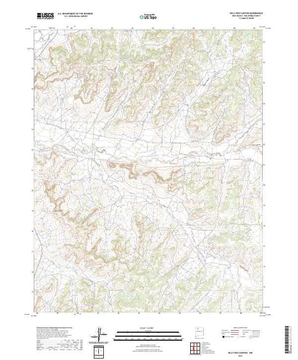
2023 Map of Billy Rice Canyon
USGS Topo · Published 2023About this map
Billy Rice Canyon and the surrounding drainage systems of the San Juan Basin define this rugged portion of Rio Arriba County. The landscape is characterized by a network of deeply incised canyons, including Cottonwood Canyon, Stray Out Canyon, and Gavilan Canyon, which all feed toward the prominent Cañada Larga valley. This 2023 survey illustrates the modern configuration of rural access roads like Co RD 529 and Co RD 411 that traverse these high-desert plateaus. Water remains a critical element for local land use, evidenced by features such as Leeson Spring situated at the head of Leeson Canyon. The terrain is marked by distinctive formations like the Adobe Knobs, while the Public Land Survey System boundaries, such as t24n r3w, provide the essential grid for current property and resource management in this arid territory.
Find a feature on this map
20 named features on this map. Tap any name to fly to it.
Don’t see what you’re looking for? This feature index may not catch every label — zoom into the map to look around manually.
Map Details
Editions of this 2023 Billy Rice Canyon Map
This is the sole edition of this map. No revisions or reprints were ever made.
Other maps of this area

1889 · Largo
USGS Topo · 1:250,000

1895 · Largo
USGS Topo · 1:250,000

1954 · Aztec
USGS Topo · 1:250,000

1958 · Aztec
USGS Topo · 1:250,000

1962 · Aztec
USGS Topo · 1:250,000

1963 · Lapis Point
USGS Topo · 1:24,000

1963 · Schmitz Ranch
USGS Topo · 1:24,000

1963 · Otero Store
USGS Topo · 1:24,000

1963 · Lindrith
USGS Topo · 1:24,000
1963 · Ojito
USGS Topo · 1:24,000