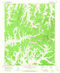
1963 Map of Ojito
USGS Topo · Published 1965About this map
The Continental Divide winds through this high-desert landscape in Rio Arriba County, marking a topographic backbone between deep drainages. To the west, the Jicarilla Apache Indian Reservation encompasses much of the territory, including the prominent Tapicito Ridge and the steep walls of Sleeper Canyon. Early mid-century ranching and infrastructure are evident at the Huffman Ranch and the small settlement of Ojito, while a lone Cem near the border of the reservation suggests the area's deeper family history.
Find a feature on this map
17 named features on this map. Tap any name to fly to it.
Don’t see what you’re looking for? This feature index may not catch every label — zoom into the map to look around manually.
Map Details
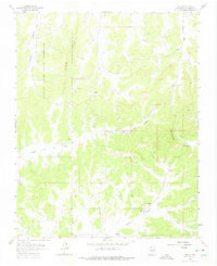
Editions of this 1963 Ojito Map
2 editions found
Other maps of this area

1889 · Largo
USGS Topo · 1:250,000

1895 · Largo
USGS Topo · 1:250,000

1909 · Gallina
USGS Topo · 1:125,000

1954 · Aztec
USGS Topo · 1:250,000

1955 · Llaves
USGS Topo · 1:62,500

1955 · Boulder Lake
USGS Topo · 1:62,500

1958 · Aztec
USGS Topo · 1:250,000

1962 · Aztec
USGS Topo · 1:250,000

1963 · Schmitz Ranch
USGS Topo · 1:24,000

1963 · Lindrith
USGS Topo · 1:24,000