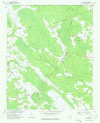
1972 Map of Bingham
USGS Topo · Published 1975About this map
Bingham serves as a focal point in this rural landscape at the border of Marlboro and Dillon Counties. The area is characterized by distinct elliptical depressions known as bays, including the large Hilson Bay, Indigo Bay, and the water-filled Catfish Bay. This specialized terrain dictates the local drainage, where Catfish Canal and Reedy Creek navigate the low-lying wetlands. The settlement pattern follows the high ground between these features, connecting Blenheim in the north to Brownsville and Mallory in the south.
Find a feature on this map
24 named features on this map. Tap any name to fly to it.
Don’t see what you’re looking for? This feature index may not catch every label — zoom into the map to look around manually.
Map Details
Editions of this 1972 Bingham Map
2 editions found
Other maps of this area

1942 · Rockingham
USGS Topo · 1:125,000

1943 · Gum Swamp
USGS Topo · 1:62,500

1953 · Florence
USGS Topo · 1:250,000

1954 · Florence
USGS Topo · 1:250,000

1960 · Latta
USGS Topo · 1:24,000

1960 · Dillon West
USGS Topo · 1:24,000

1971 · Minturn
USGS Topo · 1:24,000

1972 · Drake
USGS Topo · 1:24,000

1972 · Clio
USGS Topo · 1:24,000
1972 · Oak Grove
USGS Topo · 1:24,000