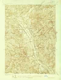
1937 Map of Binghamton East
USGS Topo · Published 1937About this map
Binghamton and the surrounding river valley are captured here in a 1937 survey that highlights the region's intense rail and industrial infrastructure before modern highway expansion. The Susquehanna River serves as the central corridor, flanked by the competing tracks of the Erie RR and the Delaware Lackawanna and Western RR. On the northern hills, the sprawling grounds of the State Hospital and local landmarks like the Julius Rogers Sch stand near the river bend.
Find a feature on this map
39 named features on this map. Tap any name to fly to it.
Don’t see what you’re looking for? This feature index may not catch every label — zoom into the map to look around manually.
Map Details
Editions of this 1937 Binghamton East Map
2 editions found
Other maps of this area

1904 · Binghamton
USGS Topo · 1:62,500

1905 · Nineveh
USGS Topo · 1:62,500

1932 · Susquehanna
USGS Topo · 1:62,500

1934 · Castle Creek
USGS Topo · 1:24,000

1935 · Binghamton West
USGS Topo · 1:24,000

1935 · Chenango Forks
USGS Topo · 1:24,000

1935 · Susquehanna
USGS Topo · 1:62,500

1937 · Binghamton East
USGS Topo · 1:24,000

1942 · Binghamton West
USGS Topo · 1:31,680

1942 · Castle Creek
USGS Topo · 1:31,680