
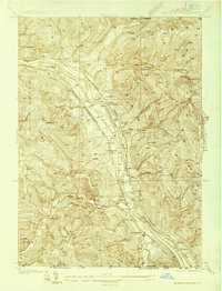
1937 Map of Binghamton East
USGS Topo · Published 1937About this map
The Susquehanna River corridor dominates this 1937 landscape, serving as a primary transportation artery for three major railroads: the Erie, Delaware and Hudson, and the Lackawanna and Western. Along the riverbanks, small settlements and industrial points like Conklin Sta, Langdon, and Collier demonstrate the rail-dependent economy of the pre-war era. To the west, the sprawling State Hospital grounds mark the edge of Binghamton, while the surrounding hills of Kirkwood and Conklin are dotted with a dense network of local schoolhouses, including Acre Sch, School No 11, and Treadwell Sch. This survey provides a clear view of the rural-to-urban transition of Broome County before modern highway expansion, preserving the locations of family-named hollows like Stanley Hollow and Sherwood Hollow near the New York Pennsylvania state line.
Find a feature on this map
50 named features on this map. Tap any name to fly to it.
Don’t see what you’re looking for? This feature index may not catch every label — zoom into the map to look around manually.
Map Details
Editions of this 1937 Binghamton East Map
2 editions found
Other maps of this area

1904 · Binghamton
USGS Topo · 1:62,500

1905 · Nineveh
USGS Topo · 1:62,500

1932 · Susquehanna
USGS Topo · 1:62,500

1934 · Castle Creek
USGS Topo · 1:24,000

1935 · Binghamton West
USGS Topo · 1:24,000

1935 · Chenango Forks
USGS Topo · 1:24,000

1935 · Susquehanna
USGS Topo · 1:62,500

1942 · Binghamton West
USGS Topo · 1:31,680

1942 · Castle Creek
USGS Topo · 1:31,680

1942 · Chenango Forks
USGS Topo · 1:31,680