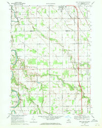
1969 Map of Birch Run South
USGS Topo · Published 1971About this map
The Flint River winds through the northwestern corner of this landscape, passing the settlement of Taymouth and the Indian Cem. This 1969 survey captures the rural boundary between Saginaw and Genesee counties, where a grid of section roads like Willard Road and Dixie Highway connects agricultural tracts and small community centers. To the east, the Chesapeake and Ohio railroad runs parallel to the growing settlement of Birch Run, which features a localized Oil Field and substation. Genealogy interest is anchored by several local landmarks, including the Taymouth Ch, Montrose Cem, and the Edgerton Sch. The southern portion of the map shows the transition into more developed areas near Westport Airport and the fringes of the Clio Golf Course, illustrating the region's mid-century shift toward suburban and recreational land use.
Find a feature on this map
66 named features on this map. Tap any name to fly to it.
Don’t see what you’re looking for? This feature index may not catch every label — zoom into the map to look around manually.
Map Details
Editions of this 1969 Birch Run South Map
2 editions found
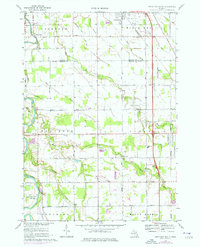
Other maps of this area

1919 · Saginaw
USGS Topo · 1:62,500

1919 · Burt
USGS Topo · 1:62,500

1920 · Flint
USGS Topo · 1:62,500

1921 · Burt
USGS Topo · 1:62,500

1922 · Flint
USGS Topo · 1:62,500

1941 · Saginaw
USGS Topo · 1:62,500

1943 · Burt
USGS Topo · 1:62,500

1943 · Saginaw
USGS Topo · 1:62,500

1943 · Flint
USGS Topo · 1:62,500

1954 · Flint
USGS Topo · 1:250,000