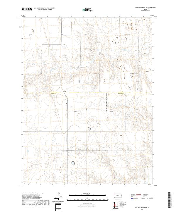
2022 Map of Bird City South SW
USGS Topo · Published 2022About this map
Little Beaver Cr meanders across the northern reaches of this High Plains landscape, cutting through the section lines of the Public Land Survey System. The map documents a predominantly agricultural region where the boundary between Cheyenne Co and Sherman Co is clearly demarcated along Co Rd 80. This 2022 survey illustrates the strict grid of rural infrastructure, where major north-south thoroughfares like Commerce Rd and Co Rd 21 intersect with east-west routes such as Co Rd 78 and Co Rd D. The terrain is characterized by gradual elevation changes and drainage patterns that feed into the central creek bed, reflecting the enduring township and range organization of Western Kansas.
Find a feature on this map
21 named features on this map. Tap any name to fly to it.
Don’t see what you’re looking for? This feature index may not catch every label — zoom into the map to look around manually.
Map Details
Editions of this 2022 Bird City South SW Map
This is the sole edition of this map. No revisions or reprints were ever made.
Other maps of this area

1951 · Bird City South
USGS Topo · 1:62,500

1952 · St Francis 3
USGS Topo · 1:62,500

1954 · Goodland
USGS Topo · 1:250,000

1956 · Goodland
USGS Topo · 1:250,000

1957 · Goodland
USGS Topo · 1:250,000

1966 · Goodland NW
USGS Topo · 1:24,000

1966 · Ruleton NE
USGS Topo · 1:24,000

1966 · Goodland NE
USGS Topo · 1:24,000
1978 · St. Francis 3 SE
USGS Topo · 1:24,000
1978 · Drury Creek
USGS Topo · 1:24,000