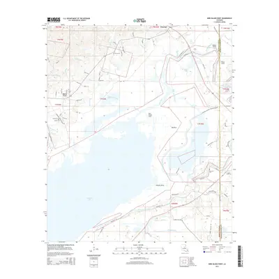
2015 Map of Bird Island Point
USGS Topo · Published 2015About this map
The expansive waters of Catahoula Lake dominate the southern portion of this LaSalle Parish landscape, where the Little River winds through complex bayous and river bends. The settlement of Whitehall sits near the northern boundary, while the small community of Sharp Town is situated further west along the hills. The map captures a transitional zone between the elevated terrain of the northwest and the low-lying wetlands and islands of the east, including Rabbit Island and Picket Island at the confluence of several waterways. Genealogists and local historians will find a high concentration of burial sites throughout the area, such as Chevallier Cem, McClure Cem, and Spencer Bayou Cem. The intricate network of small streams like Hickory Br and Gelvin Cr feeds into the larger basin, illustrating the drainage patterns that define this riverine environment.
Find a feature on this map
84 named features on this map. Tap any name to fly to it.
Don’t see what you’re looking for? This feature index may not catch every label — zoom into the map to look around manually.
Map Details
Editions of this 2015 Bird Island Point Map
This is the sole edition of this map. No revisions or reprints were ever made.
Other maps of this area

1935 · Tooleys
USGS Topo · 1:62,500

1941 · Manifest
USGS Topo · 1:62,500

1941 · Jena
USGS Topo · 1:62,500

1941 · Buckeye
USGS Topo · 1:62,500

1941 · Tooleys
USGS Topo · 1:62,500

1953 · Alexandria
USGS Topo · 1:250,000

1953 · Natchez
USGS Topo · 1:250,000

1955 · Alexandria
USGS Topo · 1:250,000

1956 · Natchez
USGS Topo · 1:250,000

1958 · Jena
USGS Topo · 1:62,500